
The Tempisque River: Natural and Cultural Axis of Ancient Greater Nicoya
Museo Indígena Contemporáneo Infographic
From the volcanic slopes of the Guanacaste Mountain Range to the wetlands of the Gulf of Nicoya, the Tempisque has shaped landscapes, ecosystems, and human societies across northwestern Costa Rica for millennia.
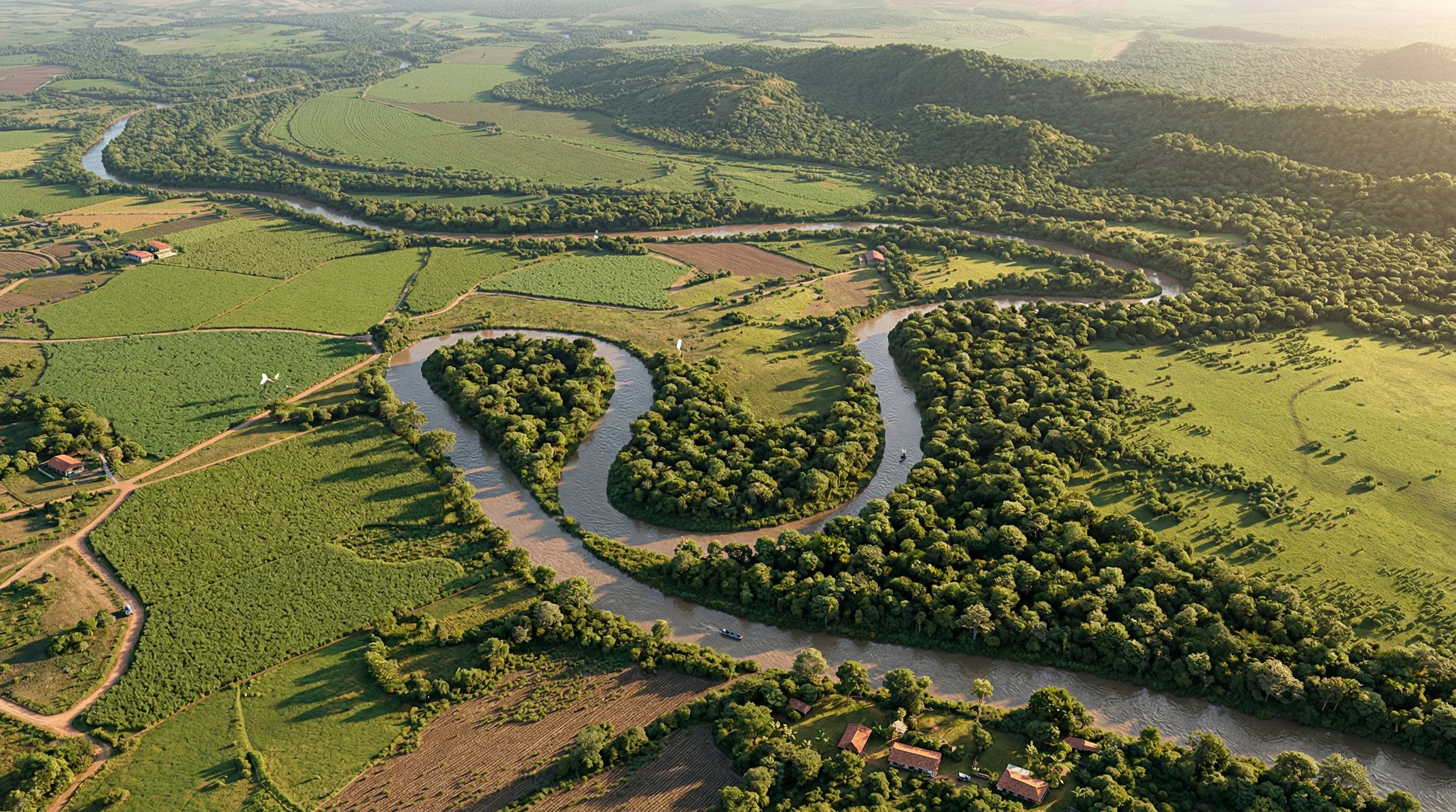
Costa Rica. A vast tropical plain stretches between volcanoes, dry savannas, and coastal wetlands. Flowing through this landscape is the Tempisque River, one of the most important river systems on the Central American Pacific coast. Rising on the slopes of the Guanacaste Mountain Range, near the Orosí Volcano, it travels approximately 144 kilometers south before emptying into the Gulf of Nicoya.
Along its course, the river winds through seasonal savannas, floodplains, and extensive mangrove forests, forming part of the ecological system of Palo Verde National Park and the lower Tempisque wetlands, one of Costa Rica’s most biodiverse regions. During the rainy season, its waters overflow across the alluvial plain, feeding temporary lagoons and ecosystems that have sustained both human and wildlife populations for millennia.
The Tempisque is also part of a broader hydrological system connecting rivers, estuaries, mangroves, and floodplains throughout the Gulf of Nicoya. This ecological complex — including the Tempisque watershed, the Bebedero River, and the gulf’s coastal wetlands — constitutes one of the largest and most important wetland systems on the Central American Pacific coast. The interaction between seasonal river flooding, tidal flows from the gulf, and mangrove dynamics has created, over thousands of years, a highly productive mosaic of ecosystems supporting remarkable biodiversity.
But long before becoming a geographic landmark of modern Costa Rica, the river formed part of a deeply inhabited territory. During the pre-Hispanic period, this region belonged to what is known as Greater Nicoya, a broad cultural area linked to Mesoamerica where complex agricultural societies flourished. Among them were the Chorotega, peoples of Mesoamerican tradition who settled in northwestern Costa Rica centuries before the arrival of Europeans.
These societies were organized into chiefdoms: political entities governed by regional leaders who controlled territories, trade routes, and alliance networks. In this context, rivers were not merely landscape features. They functioned as natural corridors for mobility, sources of food, and structural axes within Indigenous political territories.
The Tempisque likely also played an important role as a regional transportation route. Archaeological and ethnohistorical research suggests that the peoples of the region used monoxyl canoes — vessels carved from a single tree trunk — to navigate rivers and estuaries. During flood seasons, these waterways may have facilitated movement between inland settlements and the coastal zones of the Gulf of Nicoya, connecting agricultural communities to broader exchange networks extending across Mesoamerica.
The Tempisque region also occupied a unique geographic position within the pre-Hispanic cultural landscape of Central America. Greater Nicoya has been identified by archaeologists as a zone of interaction between the Mesoamerican cultural traditions of the north and the societies of the Intermediate Area extending into southern Costa Rica and Panama. In this context, the Tempisque basin formed part of a territory where cultural influences, artistic traditions, and trade networks converged, reflecting a long history of contact between different peoples.
Early 16th-century colonial chronicles record several names associated with the region near the lower Tempisque. Among them appears Zapandí — also transcribed as Cipancí or Sapancí in various colonial sources — identified as the name of a Chorotega chief who lived near the river’s mouth during the first encounters with the Spanish. These references appear in documents related to the Indigenous province of Nicoya, one of the region’s principal political centers at the time of conquest.
Although historians have not reached absolute consensus on whether this name referred directly to the river, the surrounding territory, or the Indigenous leader himself, the records suggest a close relationship between the fluvial landscape and the political organization of the Chorotega peoples who inhabited its banks.
Over time, colonial cartography consolidated the river’s current name. The term Tempisque appears to derive from the tree of the same name (Sideroxylon capiri), a characteristic species of the dry and riparian forests of the Mesoamerican Pacific. These hardwood trees, with their broad canopies, were common across the alluvial plains and likely served as a natural reference point for early colonizers naming the river.
Beyond its etymology, the Tempisque’s historical significance lies in its role as a territorial framework. For thousands of years, its waters connected communities, supported fishing, irrigated fertile lands, and enabled movement across a seasonally dry landscape. Agricultural villages, regional trade routes, and adaptive forms of environmental use developed along its banks in response to the rhythms of flooding.
Today, the river remains central to Guanacaste’s geography. Its waters feed agricultural irrigation systems, sustain critical ecosystems, and flow through some of Central America’s most important wetlands.
But its history is far older than modern infrastructure. Before highways, before official maps, and before the names recorded in contemporary cartography, the Tempisque already shaped a complex cultural landscape: an Indigenous territory where the river was not merely a body of water, but an axis of life, mobility, and political organization at the heart of ancient Greater Nicoya.
Fuentes consultadas
Carolyn Hall y Héctor Pérez Brignoli. Historical Atlas of Central America. Norman: University of Oklahoma Press, 2003.
Frederick W. Lange (ed.). The Archaeology of the Greater Nicoya Subarea. Gainesville: University Press of Florida, 1992.
Doris Stone. Archaeology of the North Pacific Coast of Costa Rica. Cambridge: Peabody Museum, Harvard University, 1966.
Carlos Meléndez Chaverri. Historia de Costa Rica. San José: Editorial Universidad Estatal a Distancia, varias ediciones.
Carlos Meléndez Chaverri. Indígenas de Costa Rica. San José: Editorial Costa Rica, 1977.
Instituto Geográfico Nacional de Costa Rica. Atlas de Costa Rica. San José: Instituto Tecnológico de Costa Rica.
Sistema Nacional de Áreas de Conservación (SINAC). Documentación y planes de manejo del Parque Nacional Palo Verde y de los humedales del Tempisque.
Convención Ramsar. Ficha informativa del sitio Ramsar Palo Verde–Tempisque Wetlands, Costa Rica.
Gonzalo Fernández de Oviedo. Historia General y Natural de las Indias. Siglo XVI.
Instituto Nacional de Biodiversidad. Información botánica sobre el árbol tempisque (Sideroxylon capiri)